The Plymouth Colony Archive Project
Maps & Landscape of Plymouth Colony


choose an archive room topic

This section of the Plymouth Colony Archive presents articles and images of maps, charts and other representations of the landscape of Plymouth Colony and surrounding areas of New England. Please click on a "thumbnail" image below to view a full image, or choose from the listing of topical articles and maps.
dividing bar


fort plan
View a Conjectural Plan of the
Fortified Town of Plymouth, 1622
aerial view
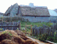
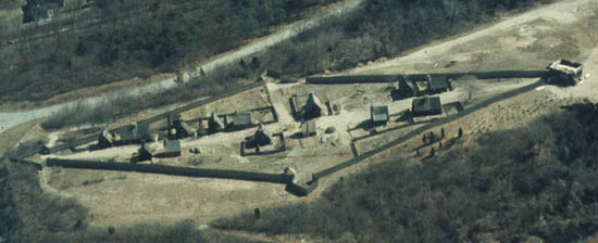
Aerial View of Plimoth
Plantation Reconstruction
Champlain
Samuel de Champlain's
Map of Plimoth, circa 1605
1677 map
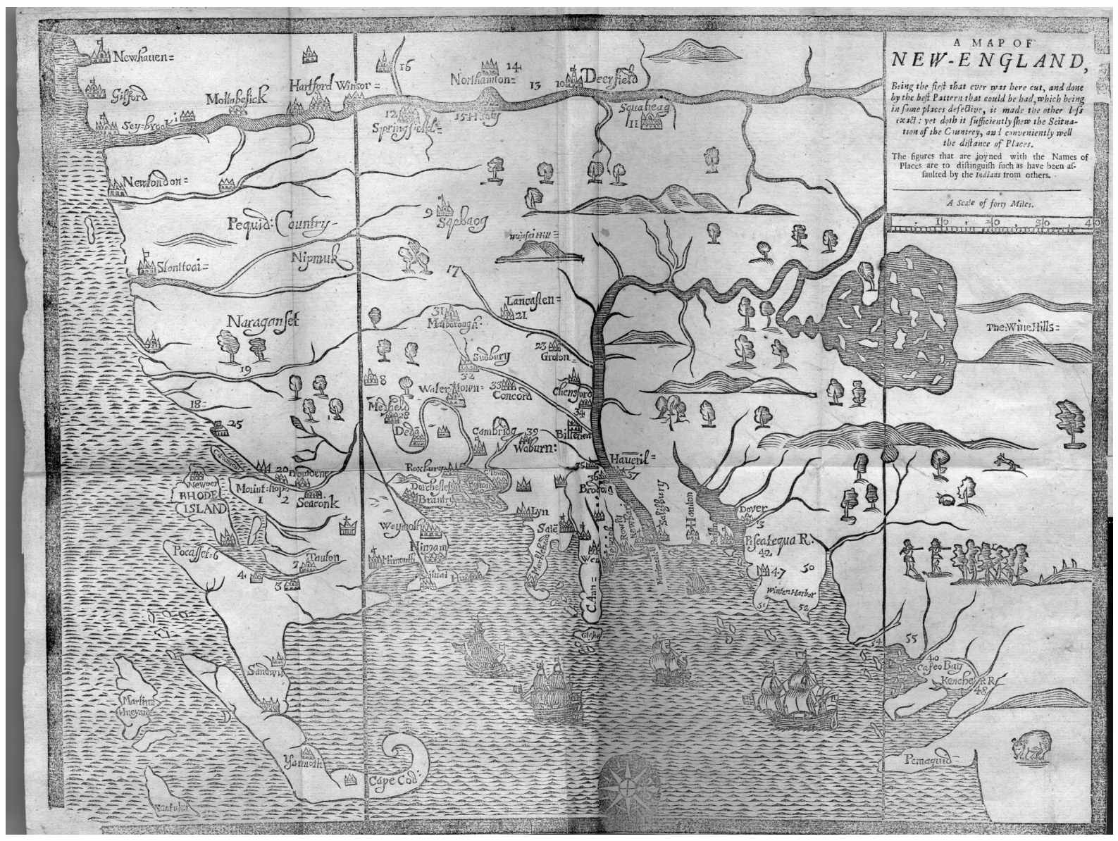
"A Map of New-England"
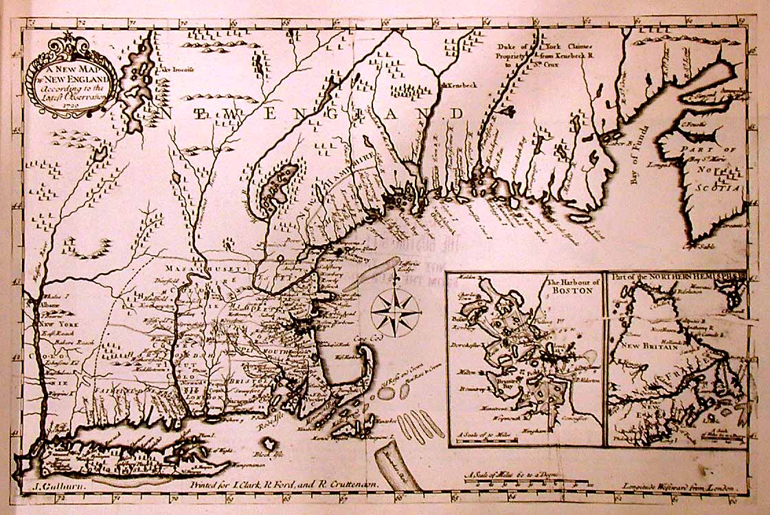
by William Hubbard, 1677
1720 map
"A New Map of
New England," 1720
town sketch
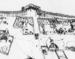
Reconstruction Sketch
of the "Pilgrim Village"
at Plimoth Plantation

Overview Articles

diamond Maps of New England & Plymouth
diamond Early Settlement of Plymouth Plantation
diamond Plymouth Town, Early Descriptions, 1620-1628
diamond Descriptions of the Fortified Town of Plymouth, 1620-1628

Sixteenth and Seventeenth Century Maps

diamond 1562 Map of America by Diego Gutiérrez
diamond Samuel de Champlain's Map of Plimoth, circa 1605
diamond Smith's Map of New England, 1614
diamond Bradford's 1620 Sketch of Plymouth
diamond Plan of Fortified Town of Plymouth, 1622
diamond Map of New England by Joannes de Laet, 1624
diamond William Wood's 1634 Map of Plymouth
diamond Map of New England by Joan Vinckeboons, 1639
diamond William Hubbard's "A Map of New-England," 1677
diamond Novi Belgii Novarque Angliae, circa 1685

Eighteenth and Nineteenth Century Maps

diamond Map of New England by T. Bowles, 1732
diamond Map of New England by T. Jefferys, 1755
diamond Map of New England by C. Bowles, 1776
diamond Map of Coast of New England by J. Des Barres, 1776
diamond 1778 Map of North America
diamond Map of Plymouth by J. Des Barres, 1780
diamond 1795 Map of North America
diamond Bourne Map of Plymouth, 1830
diamond Thacher's 1832 Map of Plymouth
diamond A Map of Plymouth Village, 1846
diamond Detail from Map of Plymouth County, 1857
diamond Detail from 1879 Plymouth County Atlas
diamond Davis 1883 Map of Plymouth, circa 1701

Maps of Related Locations in England

diamond 1787 Map of Counties in England
diamond 1787 Map of Scrooby Village in Nottinghamshire County

Other Cartography Resources

diamond Search for U.S. Survey Maps of Plymouth Area
diamond Mythic Images from Addison's Romantic Story of the Mayflower Pilgrims


Learn about our excavations
Learn more about
our Plymouth
Excavations
Learn about our excavations
Learn about the
Plymouth 400 Project
by U. Mass. Boston


dividing bar


Project Home PageArchive Home Page

Excerpts from The Times of Their Lives

Tributes to Jim Deetz (1930-2000)


© 2000-2019 Copyright and All Rights Reserved by
Patricia Scott Deetz, Christopher Fennell
and J. Eric Deetz