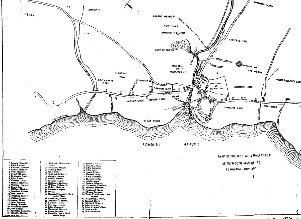
This map, entitled "Map of the Mile and a Half Tract of Plymouth Mss in 1701," was drawn by C.H. Holmes of Plymouth. It was published in 1883 by William T. Davis in Ancient Landmarks of Plymouth (Boston: Williams, 1883). The map is the result of Davis's extensive knowledge of the titles to estates in Plymouth that he details in Part I of this two-part volume. He states in the preface to Ancient Landmarks that "The map of Plymouth in 1701 is the result of the author's investigations. It exhibits the streets and ways existing at or near that time, with the houses of about two-thirds of the inhabitanats, and the names of their occupants within what was called the mile-and-a-half tract." He does not give any sources for the population figure of 600 that he cites, but it corresponds closely enough to that of Plymouth in 1690, some 775 according to figures from Evarts B. Greene and Virginia D. Harrington's American Population Before the Federal Census of 1790 (New York, 1932). There is a key on the map to the property location of many of the early residents of Plymouth, including John Rickard, John Barnes, James Cole., Jr., John Atwood, as well as sites such as the prison and grist mill. |