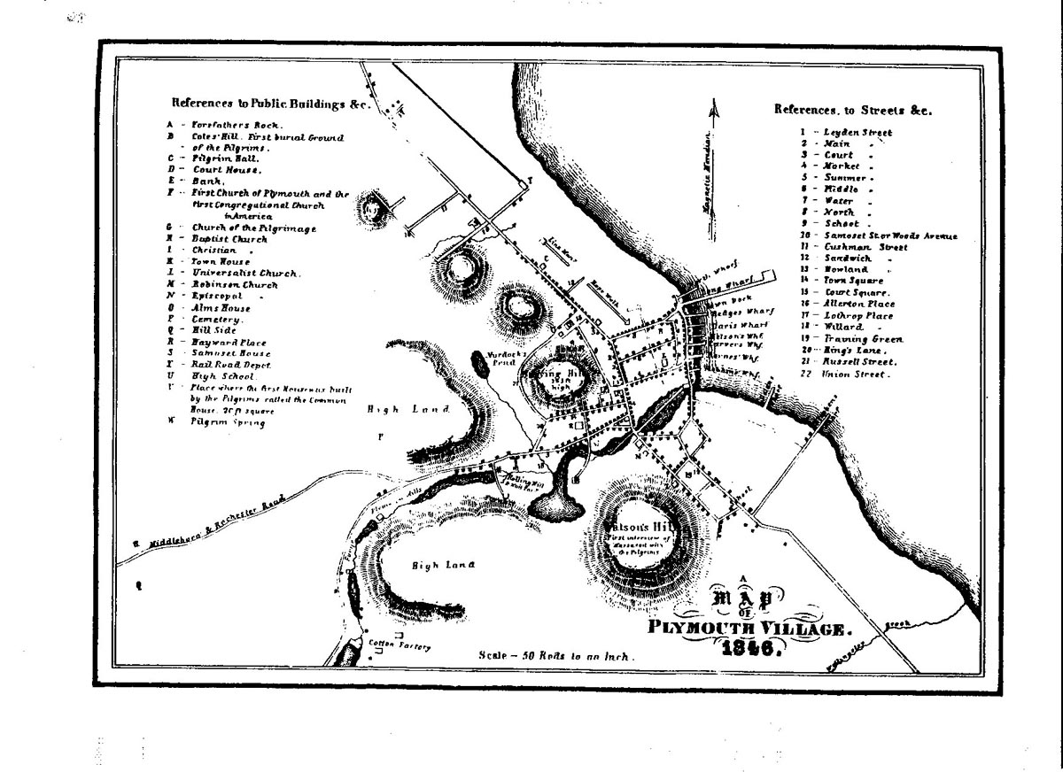
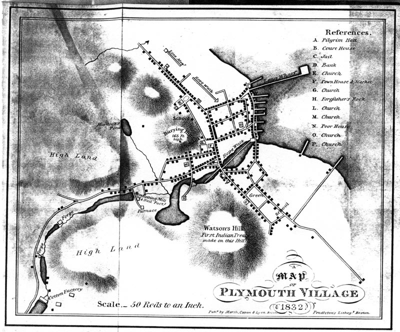
This is an update and expansion of the 1832 Thacher map, but we have not yet traced the original place of publication for the 1846 map. Additions to the 1846 version include an expansion of the References A-P from the 1830 map to include A through W, and 22 new entries under References to Streets. The scale of this map is 50 rods to an inch. |