The Plymouth Colony Archive Project
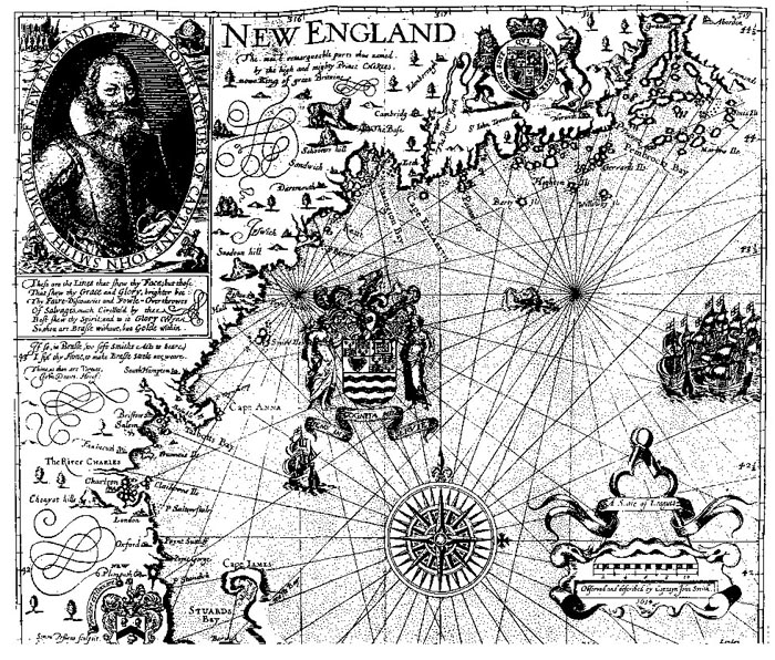
Smith's Map of New England, 1614
John Smith's map of New England was probably drawn by Simon van der Passe, the son of a Dutch engraver, based on one drawn by Smith. The English colonists who settled in Plymouth in 1620 almost certainly had access to this map.
Maps and Landscape
Project Home Page
Last Modified: December 14, 2007
© 2000-2007 Copyright and All Rights Reserved by
Patricia Scott Deetz
and
Christopher Fennell