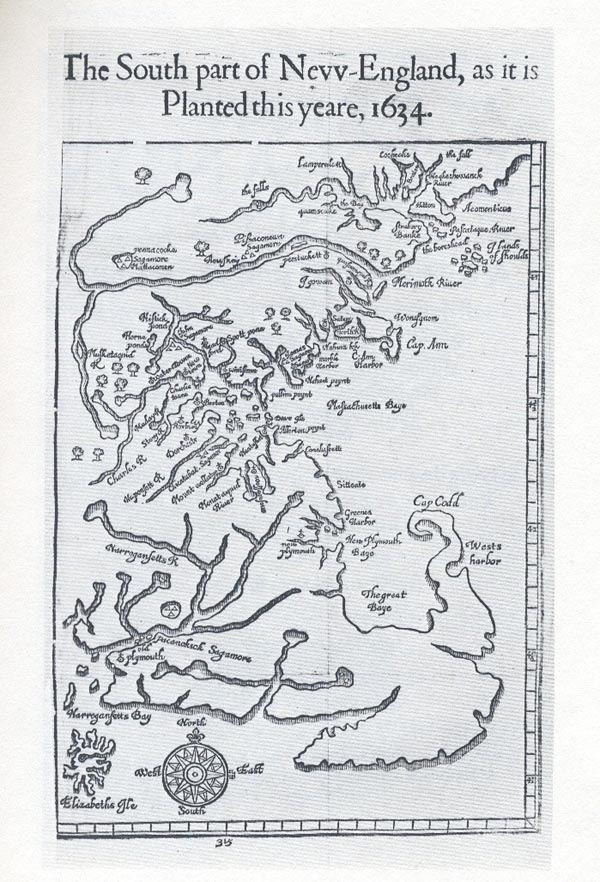
Wood's Map of "The South Part of New England, as it is Planted this yeare, 1634" was published in his New England's Prospect, in London. This map is considered generally accurate, and it provides the location of Greene's Harbor, which was the original name given to what finally became Marshfield. New Plymouth and Greene's Harbor appear on this map to the west of "Cay Codd." |