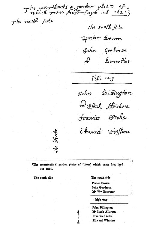
William Bradford's sketch, entitled "The meersteads & garden plots of which came first layed out 1620," is the only known map of the original town layout. This sketch is bound into the front of a manuscript volume entitled "Plimouths Great Book of Deeds of Lands Enrolled from Ano 1627 to Ano 1651." The first part of the volume is in the handwriting of Governor Bradford, as is the map. That volume is now reproduced in Vol. 12, Deeds, &c. Vol. 1, 1620-1651, of The Records of the Colony of New Plymouth in New England, edited by Nathaniel B. Shurtleff and David Pulsifer (William White, 1855-61; AMS Press, 1968). |