The Plymouth Colony Archive Project
Thacher's 1832 Map of Plymouth
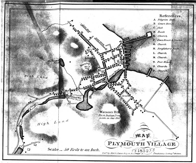
This map was published in 1832 as a fold-out in James Thacher's
History of the Town of Plymouth, from its First Settlement in 1620, to the year 1832
(Marsh, Capen & Lyon, 1832). The scale is 50 rods to an inch.
Maps and Landscape
Project Home Page
© 2000-2019 Copyright and All Rights Reserved by
Patricia Scott Deetz
and
Christopher Fennell