An Account of James Monroe's Land Holdings


© Copyright and All Rights Reserved
By Christopher Fennell


Map Images of the Monroe Hill Area


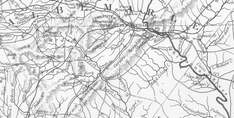
The image below provides a larger perspective, and shows the topography of Albemarle County, with Meadow Creek and Moores Creek to the north and south of the area of the Monroe Hill tract in Charlottesville, as depicted on an 1826 historical map from the Virginia State Library's collections.

area map


View a current topographic map of the Monroe Hill and University area
View an image of the surviving Monroe law office building
Review details of original records of the Monroe Hill tract


To view a particular topic on Monroe's land holdings,
click on the desired subject below
:

1. The Ash Lawn-Highland plantation
2. Monroe Hill, site of the University of Virginia
3. Parcels in Downtown Charlottesville
4. The Limestone Farm in Albemarle
5. The Oak Hill plantation in Loudoun County
6. A residence in Fredericksburg
7. A residence and land in Henrico County
8. Other speculative land holdings in Kentucky and elsewhere
9. A List of Sources and References Cited


Return to Introduction

Ash Lawn-Highland Museum Web Page

Last Modified: September 2, 2012