An Account of James Monroe's Land Holdings


© Copyright and All Rights Reserved
By Christopher Fennell


Map Images of the Monroe Hill Area


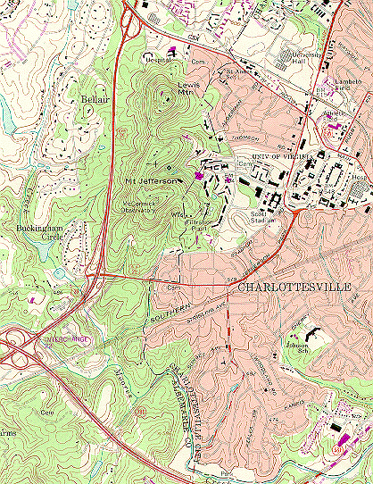
The following is an image of the current topography surrounding the site of the Monroe Hill property, on which the University of Virginia is now located. The Universal Transverse Mercator Coordinates for this property are 17.71874.421239. It is located on what is now McCormick Road on the grounds of the University of Virginia, Charlottesville (Oliver 1981).

area map


View an image of the Monroe law office building
View the Monroe Hill area on an 1826 historical topographic map
Review details of original records of the Monroe Hill tract


To view a particular topic on Monroe's land holdings,
click on the desired subject below
:

1. The Ash Lawn-Highland plantation
2. Monroe Hill, site of the University of Virginia
3. Parcels in Downtown Charlottesville
4. The Limestone Farm in Albemarle
5. The Oak Hill plantation in Loudoun County
6. A residence in Fredericksburg
7. A residence and land in Henrico County
8. Other speculative land holdings in Kentucky and elsewhere
9. A List of Sources and References Cited


Return to Introduction

Ash Lawn-Highland Museum Web Page

Last Modified: September 2, 2012