An Account of James Monroe's Land Holdings


© Copyright and All Rights Reserved
By Christopher Fennell


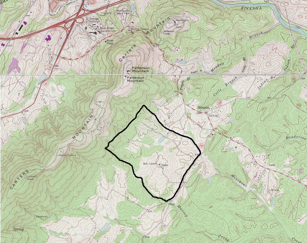
Map Images of Ash Lawn-Highland


The following is an image of the current topography surrounding the site of the Ash Lawn-Highland plantation. The dark line drawn around Ash Lawn in this image represents an area roughly equal to the current 535 1/2 acres of the site. It is not accurate in detail.

area map


View an outline of the original 1,000 acre Highland property (large file)
View an outline of the 3,500 acres of Highland at its largest (large file)
View the Highland area on Massie's 1907 "Historical Map of Albemarle"
View the Highland area on an 1826 historical topographic map
Review details of original records on the Ash Lawn-Highland tract


To view a particular topic on Monroe's land holdings,
click on the desired subject below
:

1. The Ash Lawn-Highland plantation
2. Monroe Hill, site of the University of Virginia
3. Parcels in Downtown Charlottesville
4. The Limestone Farm in Albemarle
5. The Oak Hill plantation in Loudoun County
6. A residence in Fredericksburg
7. A residence and land in Henrico County
8. Other speculative land holdings in Kentucky and elsewhere
9. A List of Sources and References Cited


Return to Introduction

Ash Lawn-Highland Museum Web Page

Last Modified: September 2, 2012