An Account of James Monroe's Land Holdings


© Copyright and All Rights Reserved
By Christopher Fennell


Map Images of Ash Lawn-Highland


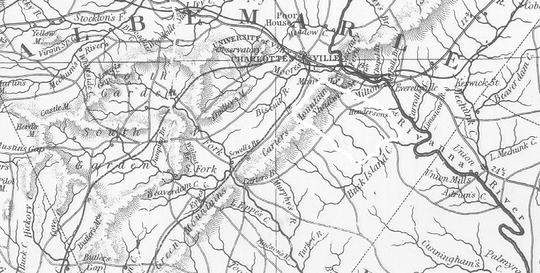
The following image provides an outline of the total 3,500 acre extent of the Highland plantation at its largest size in 1825. This outline is a rough approximation, and is not accurate in detail. From the original 1,000 acre tract, Monroe expanded Highland to the east up to Buck Island Creek, and to the west over the top of Carters Mountain. This outline is depicted below using an excerpt from an 1826 historical map from the Virginia State Library's collections.

area map


View an outline of the original 1,000 acre Highland property (large file)
View an outline of the current 535 1/2 acre Ash Lawn-Highland tract (large file)
View the Highland area on Massie's 1907 "Historical Map of Albemarle"
Review details of original records on the Ash Lawn-Highland tract


To view a particular topic on Monroe's land holdings,
click on the desired subject below
:

1. The Ash Lawn-Highland plantation
2. Monroe Hill, site of the University of Virginia
3. Parcels in Downtown Charlottesville
4. The Limestone Farm in Albemarle
5. The Oak Hill plantation in Loudoun County
6. A residence in Fredericksburg
7. A residence and land in Henrico County
8. Other speculative land holdings in Kentucky and elsewhere
9. A List of Sources and References Cited


Return to Introduction

Ash Lawn-Highland Museum Web Page

Last Modified: September 2, 2012