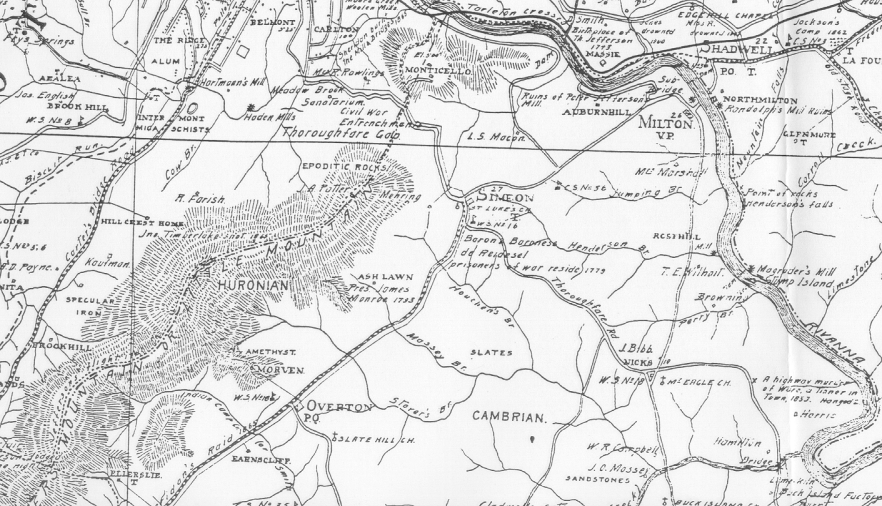
The image below is from Frank A. Massie's 1907 "New and Historical Map of Albemarle County," which is believed to be fairly accurate in its details and proportions. This map shows the location of Ash Lawn-Highland and surrounding properties and topography.
The estate called Morven, shown on this map to the south of Ash Lawn, is in the same location as William Short's earlier Indian Camp plantation. You can see Indian Camp Creek just to the southwest of Morven. Philip Mazzei's Colle plantation was located along the Colle Branch, to the east of Monticello. The road running north-south to the east of Ash Lawn was called Carter's Bridge Road on most historical maps, and is now James Monroe Parkway, State Route 795. Massie's map depicts this as the path of a raid by Col. Sheridan in 1865. Copies of this map are on file at the Albemarle County Historical Society.
Another historical map is the Green Peyton "Map of Albemarle County, Virginia," made in 1875. That map shows similar details as the later Massie map. The Greene Peyton map places the name of "Massey" next to the Ash Lawn site. The Massey family had purchased the 535 1/2 acre Ash Lawn property, and an adjoining 95 1/4 acres tract, in 1867. Copies of the Green Peyton map may be found in the Albemarle County Historical Society's collections.