An Account of James Monroe's Land Holdings


© Copyright and All Rights Reserved
By Christopher Fennell


Map Images of the Oak Hill Plantation Area


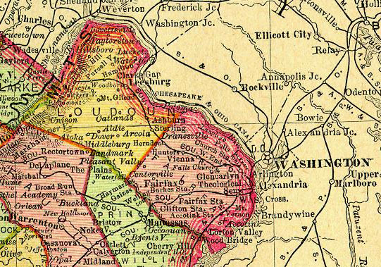
The following is an image from current topographic maps of the area in which the Oak Hill Plantation is located. The site is to the west of State Route 15, near the town of Aldie, just north of Gilbert's Corner and State Route 50, and 9 miles south of Leesburg, in Loudoun County.

area map

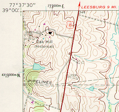
The next image is of Loudoun County and the surrounding region, from an 1895 Rand McNally map in the University of Virginia's collections. Oak Hill's proximity to the Potomac River and Washington, D.C. can be seen from this image.


1895 map excerpt


To view a particular topic on Monroe's land holdings,
click on the desired subject below
:

1. The Ash Lawn-Highland plantation
2. Monroe Hill, site of the University of Virginia
3. Parcels in Downtown Charlottesville
4. The Limestone Farm in Albemarle
5. The Oak Hill plantation in Loudoun County
6. A residence in Fredericksburg
7. A residence and land in Henrico County
8. Other speculative land holdings in Kentucky and elsewhere
9. A List of Sources and References Cited


Return to Introduction

Ash Lawn-Highland Museum Web Page

Last Modified: September 2, 2012