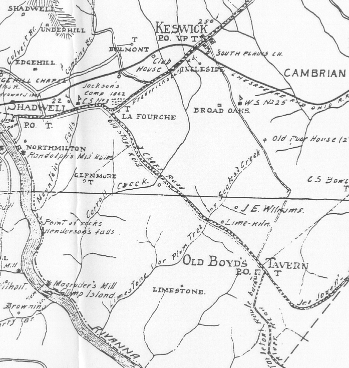
The following image is from Frank A. Massie's 1907 "New and Historical Map of Albemarle County," which is believed to be fairly accurate in its details and proportions. It shows the location of Limestone, the Limestone Branch, and the surrounding properties and topography. Copies of this map are on file at the Albemarle County Historical Society.
As can be seen from this map, the Limestone Plantation is located near Keswick, seven miles east from the city line of Charlottesville, on the "3 Chops Road," which is now State Highway 250. The Universal Transverse Mercator Coordinates for this site are 17.73202.420703 (Harris and Tiller 1977).
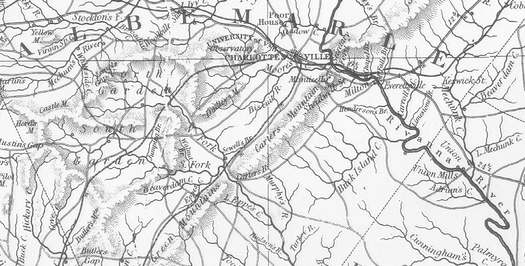
The next image provides a larger perspective, and shows the topography of Albemarle County, including the area of the Limestone Branch, as depicted on an 1826 historical map from the Virginia State Library's collections.
| Review details of original records of the Limestone Farm tract |