An Account of James Monroe's Land Holdings


© Copyright and All Rights Reserved
By Christopher Fennell


Map Images of Monroe's Lots in Charlottesville

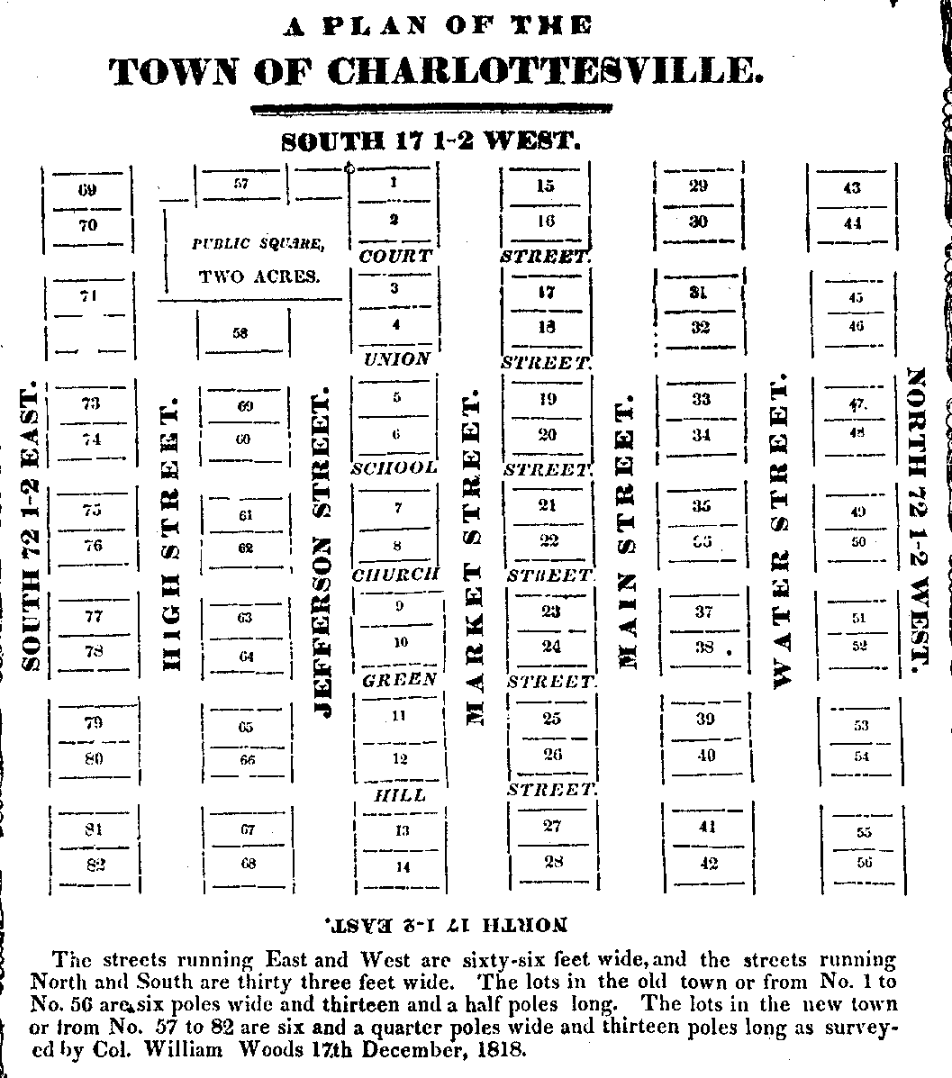
The following are images of the Monroe's lots in Charlottesville. The first image is a "Plan of the Town of Charlottesville" from a survey conducted by Col. William Woods in 1818. Copies of this "plan" are on file at the Albemarle County Historical Society. Monroe owned lots 17 and 18 depicted on this map.


plan of town lots


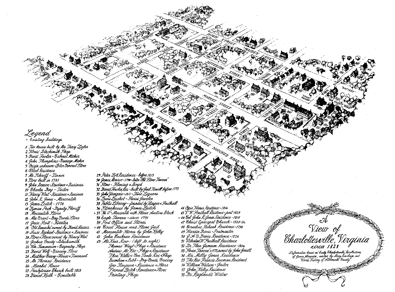
The next image is a "View of Charlottesville, Virginia, circa 1828" prepared for and published by the Albemarle County Historical Society. Monroe's lots 17 and 18 were bordered on the north and south by Market Street and Main Street (also called Three Notched Road), and bordered on the west and east by Fourth and Fifth Streets, shown here with a depiction of the "Old Stone Tavern."


1828 View of Charlottesville


Review details of original records of the Charlottesville lots


To view a particular topic on Monroe's land holdings,
click on the desired subject below
:

1. The Ash Lawn-Highland plantation
2. Monroe Hill, site of the University of Virginia
3. Parcels in Downtown Charlottesville
4. The Limestone Farm in Albemarle
5. The Oak Hill plantation in Loudoun County
6. A residence in Fredericksburg
7. A residence and land in Henrico County
8. Other speculative land holdings in Kentucky and elsewhere
9. A List of Sources and References Cited


Return to Introduction

Ash Lawn-Highland Museum Web Page

Last Modified: September 2, 2012