This web site and related links provide archaeological and historical research concerning 18th and 19th century sites in Harpers Ferry, West Virginia, and nearby Loudoun Valley, Virginia, as well as the broader region of the upper Potomac and northern Shenandoah Valleys. The author is an anthropologist and lawyer (MA, U. Penn., 1986; JD, Georgetown, 1989; PhD, U. Va., 2003), with research interests in historical archaeology, American history, and African diaspora studies. |
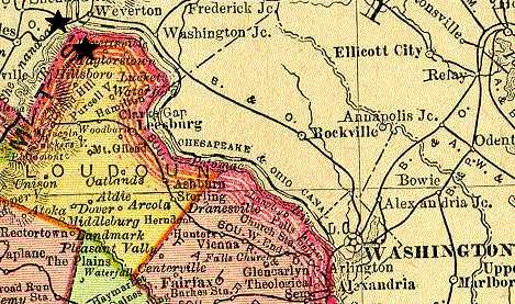 | Click on the map to the left to see Harpers Ferry, Loudoun County and the surrounding Potomac River valley from an 1895 Rand McNally map in the University of Virginia's collections. The 1999 excavation site is located in the northwestern tip of Loudoun County. Nearby Harpers Ferry is located at the confluence of the Shenandoah and Potomac Rivers. |
| Thomas Jefferson stated in his Notes on Virginia that "The passage of the Patowmac through the Blue Ridge is perhaps one of the most stupendous scenes in Nature." He believed that the view at Harpers Ferry, where the Potomac and Shenandoah Rivers meet, "is worth a voyage across the Atlantic." View an artist's rendering of Harpers Ferry circa 1807. William Roberts painted this watercolor image of the Harpers Ferry landscape entitled "Junction of the Potomac and Shenandoah, Virginia." | 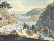 |
 | "Harper's Ferry from the Blue Ridge," by W. H. Bartlett and G. Mills, 1839. |
| View an artist's rendering of Harpers Ferry circa 1841. English artist George Harvey completed this oil painting sometime in the period of 1835-1841, with the Maryland heights in the background and the competing transport modes of railroad and canal along the Potomac River's northern shoreline. | 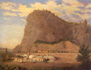 |
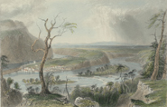
 | View artists' renderings of Harpers Ferry circa 1857 and 1859, including paintings by Ferdinand Richardt and Edward Beyers. |
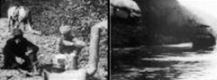
| Use the image to the right to see an 1861 photograph (a large file) of Harpers Ferry from the Library of Congress'American Memory archives. | 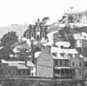 |
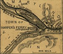 | Click on the map to the left to see an 1861 Civil War map (another large file) of the Harpers Ferry region from the Library of Congress'American Memory archives. |
| A steel engraving by R. Hinshelwood based on a painting by Granville Perkins, entitled "Harper's Ferry by Moonlight," circa 1870. | 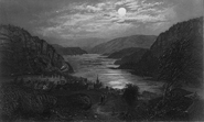 |
 | Here's a terrific restoration of 1917 footage of canal and rail traffic along the Potomac by Thomas Edison's company. "Follows a week-long, 180-mile trip on the Chesapeake and Ohio Canal through the Potomac Valley from Cumberland, Md., to Washington, D.C. Includes scenes of the locks in operation; a mile-long, hand-dug tunnel which was built in 1840; coal barges plying the canal; Maryland farming country; Harper's Ferry; and Great Falls" (Library of Congress). |
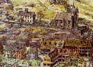
| Use the image to the left (from the Harpers Ferry Archive), to see a 1932 view of this divide in the Blue Ridge Mountains from Loudoun Heights. Lower Town, Harpers Ferry lies at the junction of the two rivers, in the center of this image, and the steeple of St. Peter's Church can be seen there. | 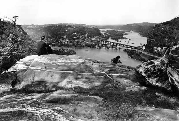 |
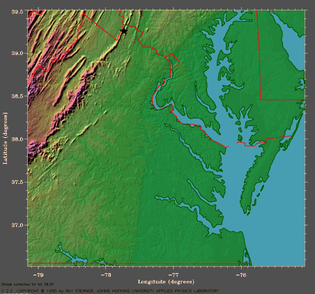 | For a broader perspective, the satellite image to the right shows the Potomac River, and a star marks the Blue Ridge and Short Hill Mountains running from Loudoun Valley to Harpers Ferry. The next ridge to the east is Catoctin Mountain. The red line marks the boundaries of Virginia, West Virginia, Maryland and Washington, D.C. Click on this image to see a larger view. |
| Use the image to the left to see a collection of remarkable landscapes of the Great Valley of Virginia at the Valley of the Shadow project, which provides an array of archives on events and issues before, during and after the Civil War in this region. Harpers Ferry is located on the northern edge of the Great Valley. |  |