| | Excavations at St. Peter's Church and School | |
| The image below shows the east-west transects of units in areas 1 and 3, and the north-south transect in area 2 of the site map, off the northwest side of the old School house. You are looking southwest from a position upslope, just north of where the old bell tower was located in the 1880's and 1890's. The School house is on the left and the privy is on the right. 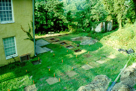
|
© 2003 Copyright and All Rights Reserved | Excavations Page |